Mtkvari/en
Z BystrzeWiki
(Różnice między wersjami)
m (→River Sections) |
m (→GPS coordinates) |
||
| Linia 36: | Linia 36: | ||
== Water level == | == Water level == | ||
== GPS coordinates == | == GPS coordinates == | ||
| + | * {{gpsentry|Mtkvari put-in|41.3778°N|43.28311°E}} | ||
| + | |||
== Map == | == Map == | ||
{{Mapa}} | {{Mapa}} | ||
Wersja z 08:15, 22 paź 2012
| Rzeki w okolicy |
|
Spis treści |
River Sections
Standard
- Put-in: on the right bank of the river, close to restaurant/campsite close to "cave city"
- Take-out: on the road bridge. It's possible to paddle further down.
- Length: 10-15 km
- Time: 2-2.5 h
- Gradient:
- Difficulty: 2-3 (3+)
- Last update: 2012 r.
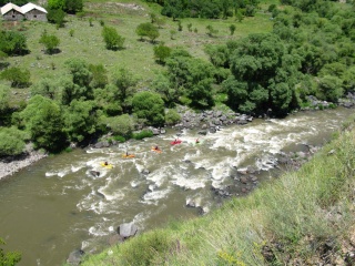
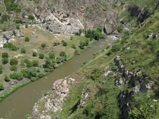
The section is easy, but very picturesque. In the middle of the section there are huge boulders in the riverbed, some of them are undercut, and there are a few siphons.
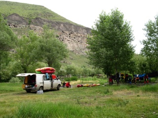
Campsite close the "cave city"


Water level
GPS coordinates
Map
External links
| To jest tylko zalążek artykułu. Jeśli potrafisz, rozbuduj go. |
| W tym artykule brakuje zdjęć. Jeśli posiadasz odpowiednie, dodaj je. |
| Ten artykuł należałoby zilustrować krótkim filmem. Jeśli posiadasz taki, dodaj go. |
| W tym opisie brakuje współrzędnych GPS. Jeśli je posiadasz, dodaj sekcję Współrzędne GPS |